RABBIT PEAK & OTHER SoCal PEAKS
February 14-17, 2020
Report by Justine Byers, Photos by Joel Brewster
Joel and I set out for Rabbit Peak via Villager Peak on Friday, February 14th. There was no love in the air, but plenty of excitement and some trepidation for the journey tomorrow. Rabbit Peak is legendary for being a beast of a peak, and is known to be one of the toughest peaks in Southern California! It is 22 plus miles, over 8000’ of gain, and no water source so our packs were heavy with roughly 2 gallons each and loads of snacks. It was to be a long day!

Sun rising on Toro Peak as we climb toward Villager Peak
We slept at the trailhead at about 800’ and were up and moving by 3 am. It was very dark but we did have half a waning moon to light our way. Joel led us across the desert floor without a GPS which, for me, was an exercise in trust, but Joel being an experienced mountaineer and navigator, the night hike went off without a hitch. We made it to about 4000’ on the ridgeline in time to see the sunrise, and Joel pointed out the route that he and Jim Morehouse had failed upon on a previous attempt. That terrain below appeared much less forgiving than the nice trail we found ourselves on which made me glad I was on this trip here and not the last.
Right before we reached the top of Villager Peak (5756’), we were gifted with a fighter jet that flew right by us. At the top of Villager we stashed some water to make the 3.5 mile up and down trek over to Rabbit a little easier. On the way, Joel decided to handle some work-related business while he had cell coverage, so I continued on ahead. We trudged along, up and down, up and down, and before we knew it, we were both enjoying the success of reaching the summit of Rabbit Peak (6623’), which turned out to be a very large boulder. The view was spectacular in every direction, but we didn’t dawdle too much, as we knew we had a long journey back to the truck.
On our way down we ran into quite a few people who were all camping on Villager for the night. I was glad I didn’t have to schlep that all that heavy gear up there and the water. We finally got back to the car around 9 pm, and I swear I think I slept 10 hours.
The next day, Sunday, we hiked around Borrego Mountain. I say hiked around because it was very flat at the top and we made a point to stand on every high point. Below Borrego Mtn. was a cool slot canyon, which we made a side trip to explore.
“A death march gaining 8500’ over 22 miles taking about 18 hours? Sounds great...sign me up!”
From Borrego, we went to the northern edge of Joshua Tree NP to hike the very easy, but pleasant South Park Peak. From the top we could see into Joshua Tree, but saw no sign of Cartman or any of the other South Park characters.
From there, we headed to the trailhead for Chaparrosa Peak to camp. This was a beautiful area with rolling hills. When we pulled into the parking lot it had a strong stench of fecal matter. I actually moved my vehicle away from a questionable pile. My first thought was that hikers were relieving themselves here but before that thought had time set in, a very large tan dog came trotting over from a nearby house and peed on my front tire and then proceeded to drop 4 very large piles of crap. That pretty much explained the smell and left Joel in awe of a canine’s pooping abilities.
The hike up Chaparrosa was straightforward, but quite nice, although it got a bit windy up high. On the drive home, we stopped for an excellent lunch at a Chinese place in Twenty-Nine Palms. Overall, it was a great and rewarding trip!

Justine on one of the high points of Borrego Mountain

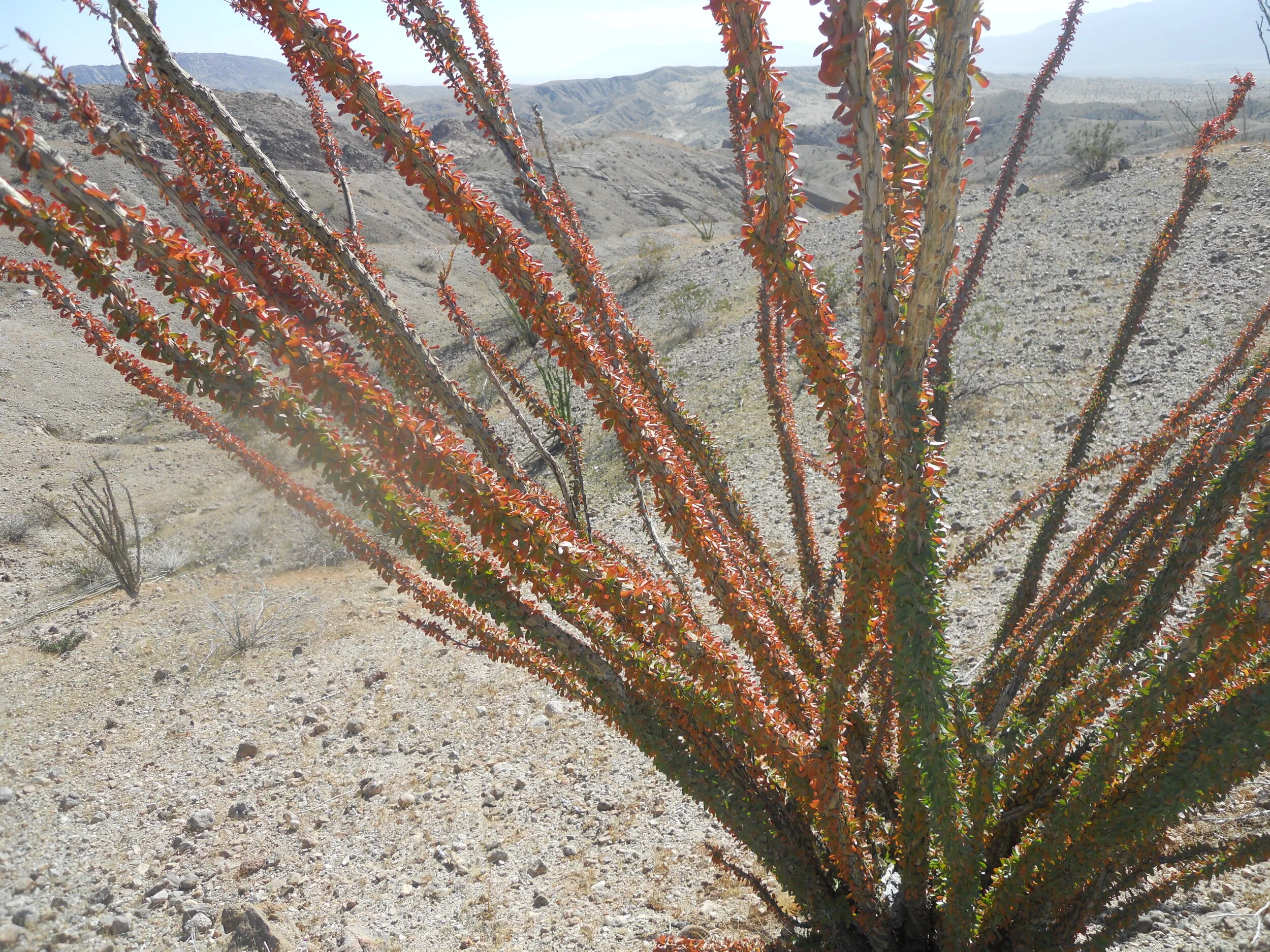
A magnificent ocotillo near Borrego Mountain


Joel and Justine on Villager Peak with Rabbit in the background

Justine on the summit of Rabbit Peak

A beautiful California King Snake in the middle of the trail on the descent
A FRIGID DAY ON PINTO PEAK
February 9, 2020
Report & Photos by Joel Brewster


Pinto Peak is a peak in Death Valley NP that I had always wanted to climb. It is located about 10 miles south of Telescope Peak, and reportedly had terrific views of Telescope as well as other surrounding peaks, so I posted an LVMC trip there for February 9th.
As the date approached, the weather appeared to be uncooperative. It predicted the weather on Pinto Peak (7508’) to be high of 30° F with 30-35 mph winds and a 20% chance of snow! I considered cancelling the trip, but decided to send an email to the two people signed up at that point describing the wintry weather predicted. Honestly, I expected, and half-hoped that they would cancel. To my surprise, Laszlo and Edit both said they were still in!
So we met bright and early at 4:10 am to make the 2.5 hour drive to Towne Pass, where we were to start the hike. We had animated discussion of our adventure to come along the way, and before we knew it, we were pulling into our parking spot as the sun was rising. It looked like a beautiful morning for a hike…until we got out of the car! It was cold and quite windy (although not as cold or nearly as windy as it would be later).
We started off toward the peak, crossing desert for the first mile or so. We tried to move briskly to stay warm. Eventually, we reached a small canyon that gave us short respite from the unrelenting wind. Unfortunately, the canyon soon became too filled with big boulders and brush to move at a good pace, so I led us up out of the canyon onto the nearby ridge. The ridge was quite pleasant and even had a faint use trail for some of it, but, boy, was that wind fierce up there! We all put on hats, hoods, anything to try keep our heads warm. We chugged our way up the fairly steep ridge, finding several cairns along the way.
Eventually our ridge ended at the base of a larger perpendicular ridge, requiring a steep climb on talus and dirt of about 400’. Once we reached the ridge, we could see yet another ridge behind it. We made our way over to it, hoping it was the summit ridge, but upon cresting it, we saw the true summit still over a mile away! Our spirits sank, but we headed toward it after losing about 200’ vertical. Ugh!
This final jaunt to the true summit was the coldest, windiest section, as we were over 7000’ and exposed to the howling wind. We estimated the wind was 35-40 mph with gusts up to 50! Factoring in the temps in the high 20’s (our water froze), we figured wind chills of single digits, maybe almost 0° F. Brrrrr! We were all warm enough, but I knew it was bad when Laszlo started complaining. For those that don’t know him, he is the happiest, most positive person in 99.99% of situations. To his credit, he kept plugging along despite his grumbling and groaning.
We finally reached the frigid summit little after 9 am. There was a small wind shelter, and I tried hunker down in it for a quick snack, but our whole summit stay was less than 5 minutes! We signed in, enjoyed the fantastic views for about 15 seconds, took a quick summit photo, and took off with visions of a warm car awaiting us.
The initial descent was very cold as we were essentially going into the wind. Though we tried to stay a bit off the crest of the ridge where the wind was the worst, at times it felt like being jabbed in the face with thousands of tiny knives. Fun stuff!
We tried to descend as quickly as possible, which got us into a bit of trouble. The summit area is quite complicated with minor ridges going in different directions, and as we were descending, we got a bit disoriented. After a quick powwow, we figured out our mistake and got back on track, though we had to cross a snow-filled valley to do it.
Once on the correct descent ridge, things went well. As we descended, the temperatures rose and it the wind lessened, making it more bearable. We actually followed the ridge all the way down to the desert floor, skipping the canyon we went part way up on the ascent. We made excellent time on the descent and were back at the car by 11 am. Edit and I both declared that it had been a “fun” outing. Laszlo said he didn’t start to agree until sipping a drink in his hot tub later that evening.
This trip was unforgettable (probably the coldest outing I’ve ever been on), and I would like to commend Edit and Laszlo for their toughness/craziness in joining me on this fine adventure!
LVMC BIO FEATURe
Ritch Go

Where were you born?
Cebu, Philippines
How long have you lived in Las Vegas?
4 years. We have moved around. Started in California for about 6 months where I bagged my first peak in the US, Mt. Wilson. Then we moved to Connecticut, we drove mostly to bag some peaks at the White mountains specifically Mt. Adams, Mt. Washington and some more. 2 years after, we moved to Florida. Fortunately we moved here after. We never thought we’d love it here. The diverse terrain in Nevada never bores us.
What is your occupation?
Nurse Practitioner
How long have you been an LVMC member?
1 year, I have been wanting to join a club to elevate my skills and experience. And I am lucky enough to have found this club. My first hike with the group was at the Adalac Benchmark. LVMC helped me a lot building my foundation. Hopefully will have mountaineering activities in the future.
What is your favorite hike/climb?
Mount Wheeler, beautiful terrain. It was a hike that I thought I would not finish. I underestimated the altitude. It was a bit chilly that day, The plan was to climb Bald, Jeff Davis, Wheeler and Baker. We only bagged Wheeler and Baker. I was exhausted and ran out of water. We went down to Baker Lake to refill and head to Baker trailhead instead of turning back. Fortunately there was a couple who were kind enough to drive us back to Wheeler Peak trailhead.
What is the most challenging hike/climb you have done?
McFarland Peak, since I soloed this hike. It was my first major solo hike. I did some minor peaks by myself before like in Connecticut. This one is special, it has some exposure that made me hesitate going up. I spent my time going up thinking how to come down. I have this fear of falling especially with no protection. I tried to search for alternative routes going down but failed. I had to return the same chute.
How did you get into hiking/climbing?
I started when I was in high school. I have always loved hiking, reaching the peak. There is something about reaching the peak, but it’s not just the peak, but the journey toward it.
What are your hobbies other than hiking/climbing?
Rock climbing, mountain biking
LAS VEGAS MOUNTAINEERS CLUB
BOARD OF DIRECTORS
President: Erica Dunstan
Vice President/Training Director: Richard Baugh
Secretary: Laurie Jones
Treasurer: Erica Dunstan
Newsletter Editor: Joel Brewster
Outings Director: Ed Forkos
Membership Director: Eric Kassan
Website Director: Amy Brewster
Public Relations/Marketing Director: Open Position
Club Gear Director: Justine Byers
Social Director: Jose Witt
Community Outreach Director: Sue Beauchamp
Director-At-Large: Jenny Chapman
Director-At-Large: Barry Chapman
Past President: Kevin Humes
The Ascender is the quarterly online newsletter of the Las Vegas Mountaineers Club. All content is property of LVMC and may be used only by the original submitters. All others must obtain written consent from the Board of Directors.
All Club members are invited to submit trip reports, photos, trip listings, recipes, classified ads and other related information.SUBMIT ARTICLES TO:
Joel Brewster
Email: info@lvmc.org
CLUB MEMBERSHIP
Please send any address, phone number and email changes to Eric Kassan, membership director. LVMC currently has approximately 140 paid members or families.
If you wish to send a check instead of using PayPal online, please make your check payable to the Las Vegas Mountaineers Club and mail to: P.O. Box 36026, Las Vegas, NV 89133-6026.
Single membership is $30 per year, $85 for three years. Family annual membership is $40, $110 for three years.
CLUB GEAR
This club gear is available at no charge to members (a refundable deposit of the gear's approximate value may be required):
4-season tent
Helmets
Bear Barrels
Ice Axes*
Snowshoes
Strap-on Crampons*
Carabiners
Quickdraw
Grigris
Harnesses
Slings
Cordalette
Belay Devices
Belay Plate
Ice Tool
Ice Screws
Deadman Anchors
*Will require a signed waiver.
Non-members are not eligible to borrow club gear. Deposits taken on gear must be in the form of cash or check and will be returned upon return of equipment. Gear is also available to members for courses with no deposit required. If you have any questions or would like to inquire about club gear, please contact Justine Byers (702-514-6244) or Eric Kassan (818-679-7282).
GENERAL MEETINGS (on hold during COVID-19 State of Emergency)
The Las Vegas Mountaineers currently meet the 3rd Wednesday of each month at 7 p.m. at REI in Summerlin (January through November). The schedule is subject to change due to room availability. Check our calendar on meetup for current information.